Educational trail
Pics
Pics


Contact
Educational trail
112 rue du tétras lyre
Chamrousse 1650
38410
Chamrousse
- Spoken language(s) :
- French
Presentation
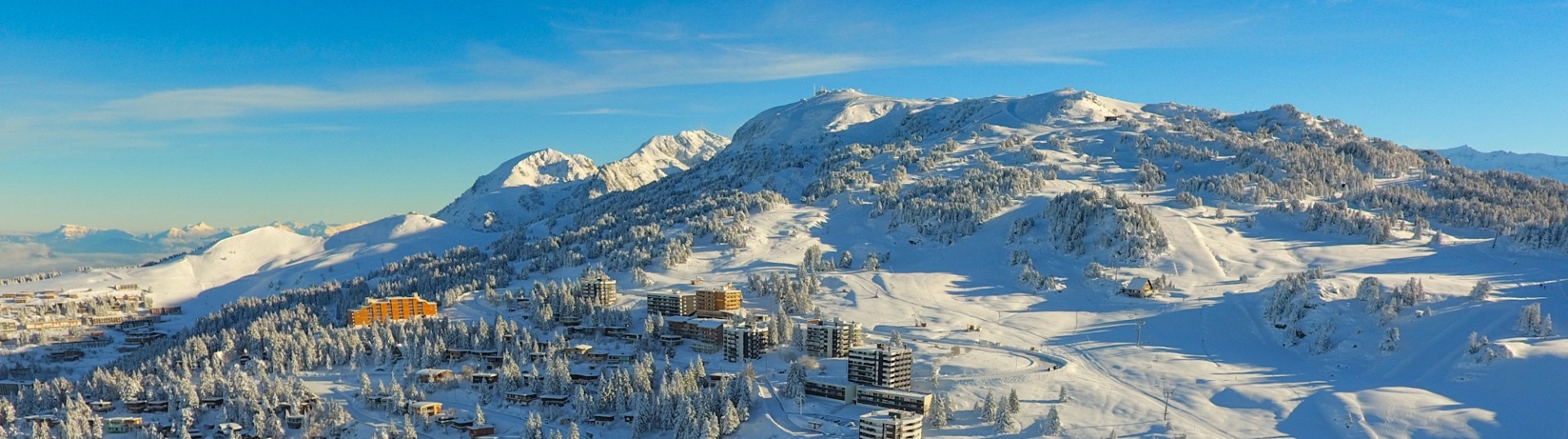
Starting from the Maison du Patrimoine et de l'Environnement in Chamrousse, at the gateway to the great natural areas of Belledonne, you can walk along an educational itinerary and discover its flora and fauna.
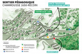
This educational trail is a discovery circuit of Chamrousse 1650 - Recoin with 6 points of interest:
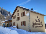
- Maison du Patrimoine et de l'Environnement: former French Alpine Club (CAF) chalet renovated with exhibition space and a program of events.
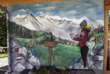
- Itinéraire pédagogique: five permanent outdoor exhibition panels, created with financial support from the Leader program.
- Arboretum: trees and species specific to Chamrousse and the southern Belledonne massif, growing naturally at altitudes above 1,700 meters on the alpine floor
- Tourist Office: a must for advice on everything to do in Chamrousse.
- Departure of the GR738 (summer): long-distance hiking trail that crosses the entire Belledonne massif (or just a day hike to the Robert lakes or stage 10 to the Pra refuge).
- Belvedere: viewpoint over the mountains and valley
There are also two picnic tables and a sundial at the Maison de l'Environnement.
Suitable for baby carriers
- Maison du Patrimoine et de l'Environnement: former French Alpine Club (CAF) chalet renovated with exhibition space and a program of events.
- Itinéraire pédagogique: five permanent outdoor exhibition panels, created with financial support from the Leader program.
- Arboretum: trees and species specific to Chamrousse and the southern Belledonne massif, growing naturally at altitudes above 1,700 meters on the alpine floor
- Tourist Office: a must for advice on everything to do in Chamrousse.
- Departure of the GR738 (summer): long-distance hiking trail that crosses the entire Belledonne massif (or just a day hike to the Robert lakes or stage 10 to the Pra refuge).
- Belvedere: viewpoint over the mountains and valley
There are also two picnic tables and a sundial at the Maison de l'Environnement.
Suitable for baby carriers
Opening periodFrom 01/06 to 30/09 daily.
Acessible from June to September.
Acessible from June to September.
Classification, Label
- Facilities and services :


General informations
- Route :
- Client profile :
- Groups greeting
- School groups greeting
- Services :
- Pets allowed
- Grouping by age (EN) :

")
")
")
")

Equipments & Services
- Leisure facilities :
- Picnic area
Tarifs
Free access.
Itinéraire
 Departure/Arrival
 Point of interest
Resort road access from Grenoble: Rocade Sud > exit no. 2 "Uriage" > Route départementale 111 (RD 111) Seiglières side.
Recommended parking: parking Henry Duhamel (P7), avenue Henry Duhamel (200 meters and about 2 minutes' walk - pay attention in winter).
Public transport - Chamrousse 1650 - Recoin stop:
- regular bus service all year round: N93 (to/from Grenoble), "Chamrousse 1650" stop (merging former T87, Transaltitude, Destination neige Skibus / nature Estibus 707)
Good to know - another stop less than 500m away (Place de Belledonne, near the Tourist Office):
- transportation by reservation during the week, excluding public holidays: Flexo 57 (to/from Uriage), "Chamrousse - Le Recoin" stop (former TAD TouGo - line G701)
- winter season resort shuttle: "Télécabine (1650)" stop (to/from Chamrousse 1750 - Roche Béranger and Chamrousse 1600 - plateau de l'Arselle/nordic area).
- Internal criteria :
- Chamrousse 1650
- Mobility :
- Shuttle stop 300 m away
We also suggest...


