
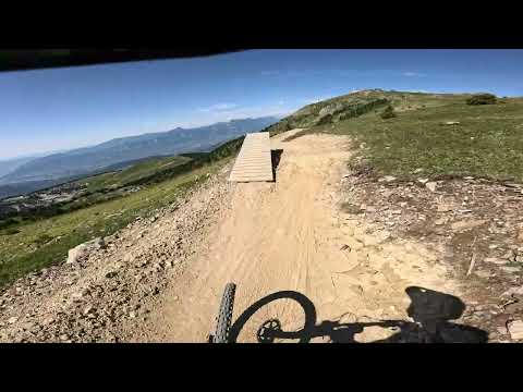
MTB track - la Chamroussienne


Mountain bike track level intermediate (blue level) in Chamrousse 1650 - Recoin.
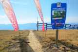
Departure: at the top of the Croix gondola (2250m)
Arrival: Chamrousse 1650 - Recoin
Duration: 15 minutes
Departure: at the top of the Croix gondola (2250m)
Arrival: Chamrousse 1650 - Recoin
Duration: 15 minutes
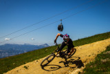
This is Chamrousse's emblematic mountain bike trail: a blue trail that covers all the resort's negative gradient.
Part of the trail is also used for the "Chamrousse Downhill challenge" on the Strava mobile app!
Downhill machines and scooters are allowed on the blue (and green) runs, where you don't need to take your wheels off the ground.
Part of the trail is also used for the "Chamrousse Downhill challenge" on the Strava mobile app!
Downhill machines and scooters are allowed on the blue (and green) runs, where you don't need to take your wheels off the ground.
Easy level: no special skills are required. However, you should already have used your mountain bike. Recommended routes from 13 years old.
Opening periodFrom 01/07 to 31/08 daily.
Timetable for the La Croix gondola lift in summer 2024: 9:15 a.m. to 5 p.m.
Timetable for the La Croix gondola lift in summer 2024: 9:15 a.m. to 5 p.m.
Contact
MTB track - la Chamroussienne
390 avenue du Père Tasse
Chamrousse 1650
38410
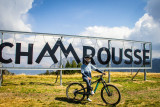
Chamrousse
- Spoken language(s) :
- French
Route
 Type of route:
:
Aller / Itinerance
Type of route:
:
Aller / Itinerance
 4.8
km (distance)
4.8
km (distance)
 15
minutes (session length)
15
minutes (session length)
 580
metres (negative drop)
580
metres (negative drop)
 Chamrousse 1650 - Recoin
 Departure/Arrival
 Point of interest
Circuit n° 1
Resort road access from Grenoble: Rocade Sud > exit no. 2 "Uriage" > Road n°111 (RD 111) Seiglières side.
Recommended parking: parking Henry Duhamel (P7), avenue Henry Duhamel (200 meters and about 2 minutes' walk from the La Croix gondola).
Public transport - Chamrousse 1650 - Recoin stop:
- regular bus service all year round: N93 (to/from Grenoble), "Chamrousse 1650" stop [merger of former T87, Transaltitude, Destination neige Skibus / nature Estibus 707].
Vehicles on this route are equipped with bike racks. Please enquire in advance.
- Mobility :
- Bus stop 500 m away
Equipments & Services
- Parking :
- Parking facilities nearby
To note
- Grouping by age (EN) :
- Grouping by age (EN)
- Help for client/transport :
- Help for client/transport
Videos / Pics
Videos / Pics


We also suggest...


