
Map of Uriage walking and hiking trails - €5


Contact
Office de Tourisme
Place de Belledonne
38410
CHAMROUSSE
Presentation
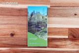
Map of hiking trails - Uriage (Saint-Martin-d'Uriage)
Uriage is the spa town near Chamrousse, located at the foot of the resort, in the valley. Ideal for relaxing before or after a mountain outing! Ideal for relaxing before or after a mountain outing!
Discover the map of hiking trails around Uriage, designed by the association Les Sentiers de Saint-Martin d'Uriage, subsidised by the commune and the département. These signposted, safe and well-maintained routes allow you to make the most of the Grésivaudan countryside.
Routes for all levels: from 2.5km to over 15km, from less than 2 hours to a full day. There's something for everyone, whether you're a family hiker, a keen walker or an explorer!
On sale at Chamrousse (and Uriage) Tourist Offices
Uriage is the spa town near Chamrousse, located at the foot of the resort, in the valley. Ideal for relaxing before or after a mountain outing! Ideal for relaxing before or after a mountain outing!
Discover the map of hiking trails around Uriage, designed by the association Les Sentiers de Saint-Martin d'Uriage, subsidised by the commune and the département. These signposted, safe and well-maintained routes allow you to make the most of the Grésivaudan countryside.
Routes for all levels: from 2.5km to over 15km, from less than 2 hours to a full day. There's something for everyone, whether you're a family hiker, a keen walker or an explorer!
- Circuit du Bit : 9 km, 500m ascent and 3h30
- Circit des Ecoliers : 6 km, 250m and 2h
- Circuit du Roux (petit) : 5 km, 200m and 1h45
- Circuit Combeloup : 11 km, 510m and 3h30
- Circuit des Crêtes : 9,5 km, 300m and 3h
- Circuit des Vignasses : 4 km, 300m and 1h45
- Circuit de Montrond : 8 km, 300m and 2h30
- Circuit des 5 cabanes: 16km, 640m and 6h30
- Circuit des Gardes: 12 km, 420m and 5h
- Circuit des Curistes: 6,2 km, 100m and 2h
- Circuit des Remparts: 3km, 130m and 1h30
- Circuit du Marais: 2,5 km, 70m and 1h15
- Circuit des Fougères: 8km, 250m and 4h
On sale at Chamrousse (and Uriage) Tourist Offices
Prices
5€ for all trail maps