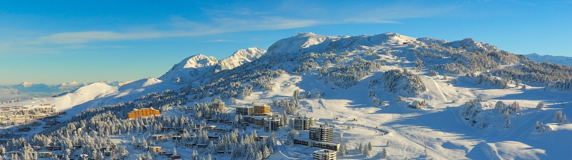
Chamrousse 1750 - Croix de Chamrousse via the Crêtes


Departure: Tourist Office Chamrousse 1750 - Roche Béranger.
If you feel like surpassing yourself, then this walk id made for you!
This hike is one of the most sporting in Chamrousse: climb a vertical drop of 500m in less than 2h.
If you feel like surpassing yourself, then this walk id made for you!
This hike is one of the most sporting in Chamrousse: climb a vertical drop of 500m in less than 2h.
On the way up, don't forget to turn around and take in the breathtaking views of the Vercors massif and the Grenoble valley.
You might even catch a glimpse of the lift personnel perched on the pylons, maintaining the equipment, or rub shoulders with the shepherd and his flock.
For the round trip, allow 3 hours (7.6km).
You might even catch a glimpse of the lift personnel perched on the pylons, maintaining the equipment, or rub shoulders with the shepherd and his flock.
For the round trip, allow 3 hours (7.6km).
Opening periodFrom 01/06 to 20/09.
According to snow conditions.
According to snow conditions.
Contact
Chamrousse 1750 - Croix de Chamrousse via the Crêtes
478 avenue du Père Tasse
Chamrousse 1750
38410
Chamrousse
- Spoken language(s) :
- French
- English
Route
 Type of route:
:
Aller / Itinerance
Type of route:
:
Aller / Itinerance
 3.8
km (distance)
3.8
km (distance)
 105
minutes (session length)
105
minutes (session length)
 510
metres (positive drop)
510
metres (positive drop)
 10
metres (negative drop)
10
metres (negative drop)
 Croix de Chamrousse
 Chamrousse 1750 - Roche Béranger
 Departure/Arrival
 Point of interest
Circuit n° 1
Station road access from Grenoble: Rocade Sud > exit no. 2 "Uriage" > Route départementale 111 (RD 111) on the Luitel side.
Recommended parking: main parking lot (P3), 390 avenue du Père Tasse (approx. 100 m, 2-minute walk).
Public transport - Chamrousse 1750 - Roche Béranger stop:
- regular bus service all year round: N93 (to/from Grenoble), "Chamrousse 1750" stop [merger of former bus routes T87, Transaltitude and Destination neige Skibus / nature Estibus 707].
- bus line / shuttle on reservation weekdays excluding public holidays: Flexo 57 to/from Uriage [former TAD TouGo transport on demand - line G701].
- winter season resort shuttle: "Centre Commercial (1750)" stop (to/from Chamrousse 1650 - Recoin and Chamrousse 1600 - plateau de l'Arselle/nordic area)
- Mobility :
- Bus stop 500 m away
Download
General informations
- Services :
- Pets allowed
Equipments & Services
- Parking :
- Parking lot
- Parking facilities nearby
- Free car park
About
Magnificent views out over the Vercors, Chartreuse, Oisans and Belledonne mountain ranges.
Pics
Pics

We also suggest...
- Croix of Chamrousse historic site


